- StandardKathmandu → Machha Khola (bus 8–10 h) · 5 days on foot to Samagaon 3,530 m · rest day · Samdo 3,860 · Dharmasala 4,460 · Larke La 5,106 → Bimthang 3,720 · Dharapani 1,860 · jeep and bus back = 12–14 days
- Short and long10 days: Himalayan Scenery (one rest day, Samagaon–Dharmasala in one day) · 17–19 days: Outshine, World Himalaya, Explore Himalaya, Great Vision, Alpine Club (start Arughat or Soti Khola, exit on foot) · 21–25 days with Tsum Valley
- AscentAround 6,500 m up and 6,500 down over the whole circuit; pass day 650 up, 1,400 down
- CheckpointsJagat (entry to the restricted area), Namrung (MCAP), Dharapani (exit, ACAP); permits are stamped
- ConnectionDharapani lies on the Annapurna Circuit: jeep to Besisahar (3–4 h) or onwards to Manang and over the Thorong La (+ 7–9 days)
Ten, thirteen or nineteen days: what the number means
The days in the titles count from Kathmandu and mostly to Kathmandu, with or without arrival and departure days. Twelve to fourteen days are the standard: a driving day out, nine to ten days on foot with one rest day, a driving day back, plus one or two hotel nights at the start with the fourteen-day tours. Magical Nepal needs thirteen days for two rest days because it counts no hotel night. Ten days (Himalayan Scenery, Places Nepal short version) means: Machha Khola to Dharapani in eight days with one rest day and the jump from Samagaon to Dharmasala – 900 m of ascent above 3,500 m in one day, which breaks the guideline of “300 to 500 m of sleeping altitude per day”. If you book that, you should have been at 4,000 m before. Seventeen to nineteen days (Outshine, Explore Himalaya, Great Vision, Alpine Club, World Himalaya) mean two to three hotel nights with a city tour, a start further down at Soti Khola or Arughat and, after the pass, two to three more days on foot down the Marsyangdi valley – the old route that existed before the road. 21 to 25 days are the circuit with the Tsum Valley.
The stages
Eight sections: the approach, the gorge, the Nubri valley, the rest day, the altitude, the pass, the exit and the Tsum loop. Altitudes per Sole Encounters, Magical Nepal and Alpine Club of Himalaya, rounded; below each section it says which packages walk it that way.
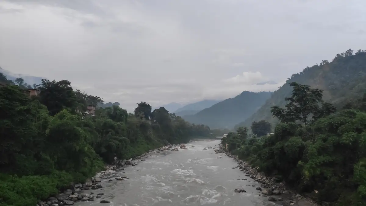
The trek begins with a day on the bus: Prithvi Highway to Malekhu, then Dhading Besi, Arughat and the track up the Budhi Gandaki.
Almost all packages drive from Kathmandu to Machha Khola at 900 m on day one, eight to ten hours, the last three on a dirt track; Sole Encounters, Lets Trip, Yak Ru, Nepal Treks and Heaven Himalaya in a private vehicle, Magical Nepal, Trek Mania, Places Nepal and Nepal Trek Ways on the public bus from Gongabu. Those who start at Soti Khola (710 m) – Nepal Lion, Heaven Himalaya, Outshine, Great Vision, Himalayan Leisure, Adventure Master – have one more day on foot by the river that the road has since overtaken. Alpine Club of Himalaya still starts in Arughat and walks the whole old route. The night in Machha Khola is warm: rice fields, bananas, the river loud in its bed.
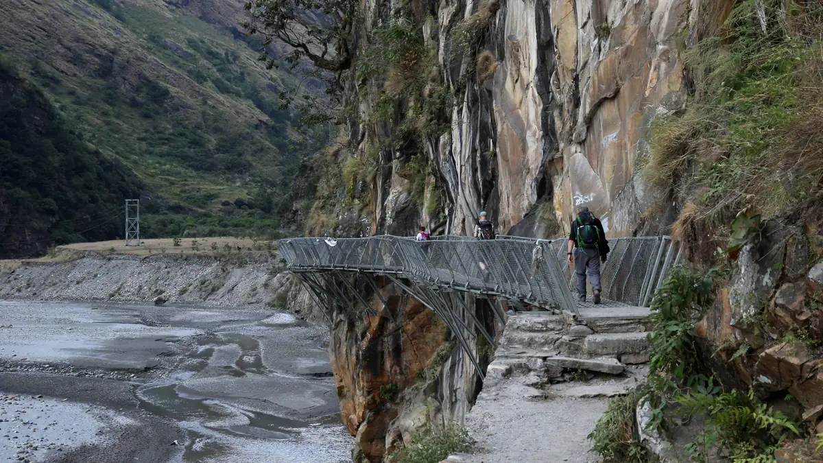
Two days in the Budhi Gandaki gorge: hot springs at Tatopani, the checkpoint at Jagat where the restricted area begins, bridges over the river.
From Machha Khola the trail follows the river through Khorlabesi to the hot springs of Tatopani, over a suspension bridge to Dobhan and up the rock to Jagat at 1,340 m, six to seven hours. In Jagat the police check the permit: from here Manaslu is a restricted area, nobody continues without a registered guide. On day three via Salleri and Sirdibas, the long bridge to Philim (the largest Gurung village in the valley), past the turn-off to Lokpa – where the Tsum Valley begins – and through bamboo to Deng at 1,860 m: four houses, three lodges, the first mani walls. Those who want Tsum turn off here and return after five to eight days.
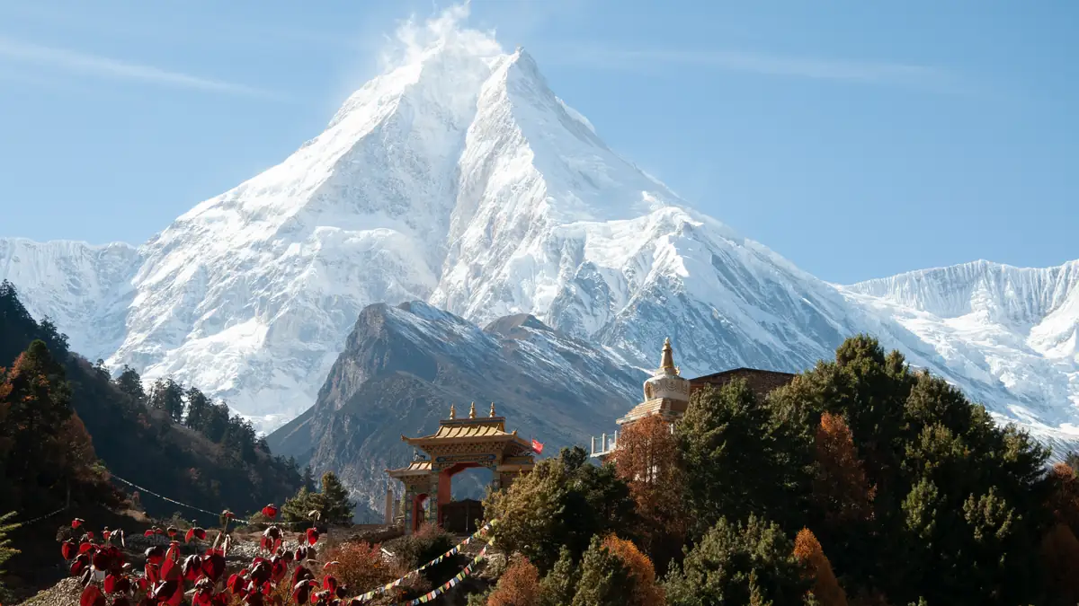
Out of the gorge into Tibetan Nubri: Namrung with the second checkpoint, Lho with the Ribung monastery and the first big view of Manaslu, Samagaon beneath the ice wall.
Beyond Deng the trail changes valley side to Rana and Bihi Phedi, through pines and rhododendrons to Ghap and Namrung at 2,630 m, where the second permit office stands and the houses turn Tibetan. From here two shorter days: Lihi, Sho, Lho at 3,180 m with the Ribung monastery and Manaslu standing for the first time fully at the head of the valley; then Shyala and Samagaon at 3,530, the largest village in the Nubri valley, with the Pungyen monastery on the ridge opposite. Sole Encounters, Trek Mania, Magical Nepal, Alpine Club and Explore Himalaya sleep in Lho, Places Nepal, Lets Trip, Yak Ru and Three Jewels in Shyala; Adventure Glacier, Discover Altitude, Nepal Lion and others walk Namrung–Samagaon in one day – 900 m of ascent above 3,000 m.
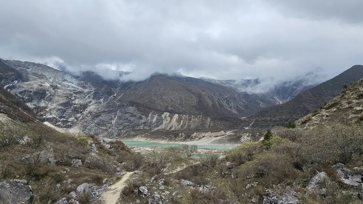
The day that decides the pass: climb high, sleep low. Three destinations are on offer, and the packages differ in whether there is a second rest day at Samdo.
Samagaon lies at 3,530 m, Dharmasala at 4,460, the pass at 5,106 – with only two nights in between. The rest day in Samagaon is therefore fixed in 27 of the 32 products: briefly to Birendra lake (3,690 m, one hour), half a day to the Pungyen monastery on the ridge opposite (around 4,000 m, three to four hours), or a full day to Manaslu base camp at 4,400 to 4,800 m above the glacier, six to seven hours. A second rest day at Samdo (3,860 m) with a walk to the Tibet border or up the Gya La is offered by Magical Nepal, Great Vision, Awesome Holidays, Explore Himalaya, Adventure Glacier, Himalayan Leisure and Trekking Planner. Those who have it cross the pass more safely; those who do not should really climb high on the Samagaon rest day.
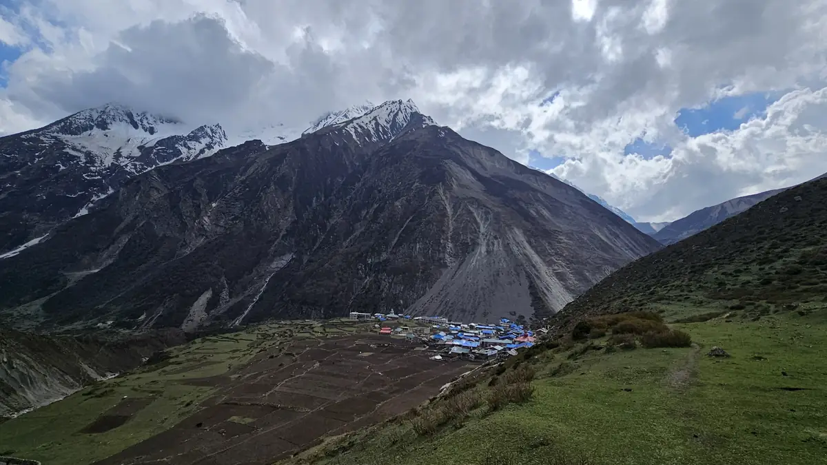
Two short days above the treeline: Samdo, the last village, and Dharmasala, which is no village – a camp of stone huts and tents at the foot of the pass.
From Samagaon over juniper pastures and mani walls to Samdo at 3,860 m, three to four hours; a Tibetan village founded after 1959, with yaks and a trading path over the border, four kilometres away and closed. The next day over the wooden bridge, past the ruin of Larkya Bazaar (once a market for the Tibet trade) and in four hours to Dharmasala at 4,460 m, also called Larkya Phedi: two stone huts with dormitories, plus tents, no village, no shower, minus ten degrees at night. Sole Encounters and Three Jewels say it openly: dormitory or tent. Everyone sets off from here at three or four in the morning.
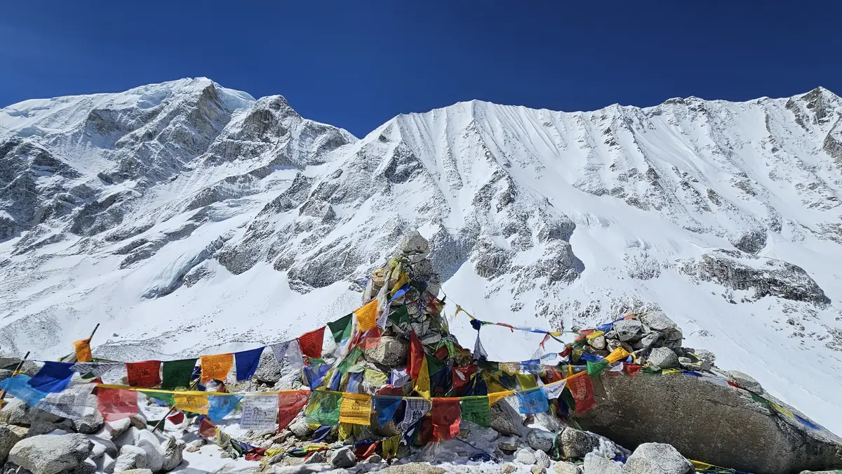
The Larke La is no climbing pass, but a long one: three to five hours of moraine to the flags, then a steep, often icy descent to Bimthang.
Departure in the dark so as to be up before the midday wind. The trail climbs gently over moraine and past a lake, then in bends to the crest with the prayer flags at 5,106 m (operators quote 5,100 to 5,215). The view: Himlung, Cheo Himal, Kang Guru, Annapurna II. The descent is the hard part – 1,400 m over scree and, in autumn, over ice; crampons or spikes help, and hardly any package mentions them. Bimthang at 3,720 m is a meadow with blue lodges beneath the west ridge of Manaslu, and the evening there is the one you have earned. Trekking Planner and Alpine Club warn of snow, Sole Encounters of the length: 24 kilometres, nine hours.
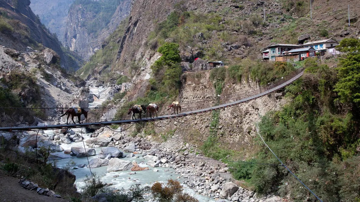
A day down through rhododendrons to Dharapani, where the Annapurna Circuit crosses – then jeep and bus, or two to three more days on foot down the Marsyangdi valley.
From Bimthang over the Sangure Kharka pasture, Karche and Gho to Tilije (2,300 m) and Dharapani (1,860 m): six to eight hours, and in Dharapani you are suddenly on the Annapurna Circuit with its jeeps and bakeries. Most packages drive from here: shared jeep to Besisahar, three to four hours of track, then six to seven hours of bus to Kathmandu – a long day in all, arriving in the evening. Trek Mania, Lets Trip, Trekking Planner, Alpine Club, Great Vision, Adventure Glacier, Explore Himalaya and Himalayan Leisure instead walk one to three more days to Tal, Chamje, Syange or Bhulbhule – the old route that the road now accompanies. If you want to continue onto the Annapurna Circuit, it is easy here: Dharapani is its usual jeep entry point.
The Tsum Valley is a side valley with its own permit, its own monasteries and no pass: six to eight more days before you rejoin the circuit at Deng.
Beyond Philim the trail leads to Lokpa, then through the Siyar Khola gorge to Chumling and Chhokangparo at 3,030 m, where the valley opens – a high valley with barley fields, mani walls and the monasteries of Rachen (nuns) and Mu Gompa at 3,700 m at the end, a day from the border. Until 2008 Tsum was entirely closed, and even today families live there in which brothers share one wife, as Accessible Adventure explains. Three packages combine it with the circuit: Trekking Planner in 25 days (USD 1,899), The Great Adventure in 25 days without an itinerary (1,999) and Accessible Adventure in 21 days (1,495 for two). The Tsum permit costs extra: in high season USD 40 for the first week.
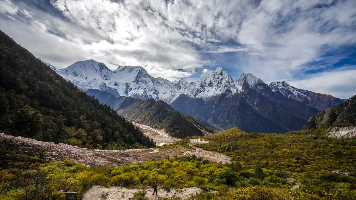
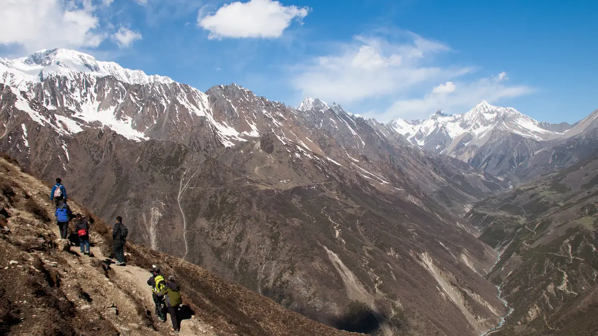
The route in stages: altitudes and itineraries from the operator data, photos illustrate the places. The boxes show where the four compared offers differ at the same spot.
Itineraries of the products
Three itineraries as they appear on Viator: the thirteen-day tour by Magical Nepal with two rest days, the ten-day tour by Himalayan Scenery and the fifteen-day tour by Sole Encounters with kilometres and ascent per day. Times are operator figures.
Magical Nepal · 13 days, two rest days, no porter 13 days · 12 nights
Direct bus from Gongabu between 6 and 8 am to Arughat, on to Machha Khola.
☾ TeehausAlong the Budhi Gandaki, monkeys in the forest, Gurung villages, Tatopani.
☾ TeehausSalleri, Sirdibas with gompas, Philim, suspension bridge, bamboo.
☾ TeehausBridge, climb to Rana, the valley turns Tibetan.
☾ TeehausMani walls, Lho with monastery, Shyala with views of Manaslu, Himalchuli, Ngadi Chuli.
☾ TeehausShort day through pines and rhododendrons, afternoon in the village.
☾ TeehausAcclimatisation in motion: Pungyen Gompa to the east or Manaslu base camp above Birendra lake.
☾ TeehausYak pastures in the wide valley, Samdo Peak as an option in the afternoon.
☾ TeehausSecond rest day: to the view over the border into Tibet, yak caravans.
☾ TeehausSlowly at altitude, Larkya Bazaar, the camp at the foot of the pass.
☾ TeehausOff early, at the top before noon; hard but doable in snow and bad weather; descent to Bimthang.
☾ TeehausThrough forest and rhododendrons via Karche to Dharapani.
☾ TeehausJeep to Besisahar, then bus to Kathmandu or Pokhara; hotel on your own.
Himalayan Scenery · 10 days compact, porter included, guide in German 10 days · 9 nights
Shared vehicle or private to Machha Khola.
☾ GasthausAlong the river through Gurung villages, Khorlabesi, to Jagat.
☾ GasthausRiver, Philim, the trail steepens, Deng.
☾ GasthausSuspension bridge, Rana, Bihi Phedi, Namrung.
☾ GasthausA long day with 900 m of ascent through Lihi, Sho, Lho and Shyala.
☾ GasthausThe only rest day: Pungyen Gompa to the east or base camp to the north.
☾ GasthausSamdo only in passing: 900 m of ascent in one day to the camp below the pass – the tight point of the ten-day tour.
☾ GasthausThe longest day: over the moraine to the pass, descent to Bimthang.
☾ GasthausDown via Karche, the valley opens, Dharapani.
☾ GasthausOn foot to Besisahar per the itinerary, then drive to Kathmandu or Pokhara.
Sole Encounters · 15 days, hotel, porter, guide in German – meals yourself 15 days · 14 nights
Pickup, briefing at the hotel.
☾ 3-Sterne-HotelHand in passport and two photos, gear check, free day; the permits are issued.
☾ 3-Sterne-HotelPrivate vehicle through the Trishuli valley and the hills to Machha Khola.
☾ TeehausTatopani, Dobhan at the confluence, bamboo, narrow ridge paths.
☾ TeehausSalleri, Philim, gorge sections; the altitude of Deng is given too high in the itinerary at 2,660.
☾ TeehausBihi, Rana, Ghap, pine and rhododendron forest.
☾ TeehausLihi, terraces, yak pastures, the Lho monastery.
☾ TeehausShyala with the big panorama, then gently to Samagaon.
☾ TeehausTo the monastery on the ridge, view of Manaslu.
☾ TeehausWooden bridge, dry yak pastures, mani walls.
☾ TeehausShort but important: acclimatisation up to the camp; night in the dormitory.
☾ SchlafsaalOff before dawn, moraine, glacier slopes, the pass, long descent.
☾ TeehausYak Kharka, pines, oaks, Dharapani.
☾ TeehausShared jeep along the Marsyangdi through Tal, private vehicle from Besisahar, farewell dinner.
☾ 3-Sterne-HotelTransfer to the airport.
Stops and walking times from the operator's Viator product data, edited for length. Maps and figures illustrate the route and are not for navigation.
Getting there and out: bus, jeep and the road that keeps coming closer
From Kathmandu to Machha Khola it is around 160 km and eight to ten hours: Prithvi Highway to Malekhu, then north to Dhading Besi on tarmac, after that a dirt track via Arughat and Soti Khola that has landslides in the rainy season. The public bus leaves Gongabu between six and eight in the morning (Magical Nepal names it); the packages with a private jeep start after breakfast. The road grows longer every year: jeeps now reach Jagat and partly beyond, and the old first trekking days Arughat–Soti Khola–Machha Khola have become a drive – only Alpine Club of Himalaya still walks them. At the other end Dharapani has been road for years: shared jeep to Besisahar (three to four hours on a bad track, USD 20 to 30 per seat), then bus or car to Kathmandu (six to seven hours) or Pokhara (four to five). If you do not want that day, keep walking: Tal, Chamje, Syange, Bhulbhule – two to three days along the road, as Trek Mania, Lets Trip, Alpine Club and Great Vision do.