25 April 2015: the village that vanished, and the village that came back
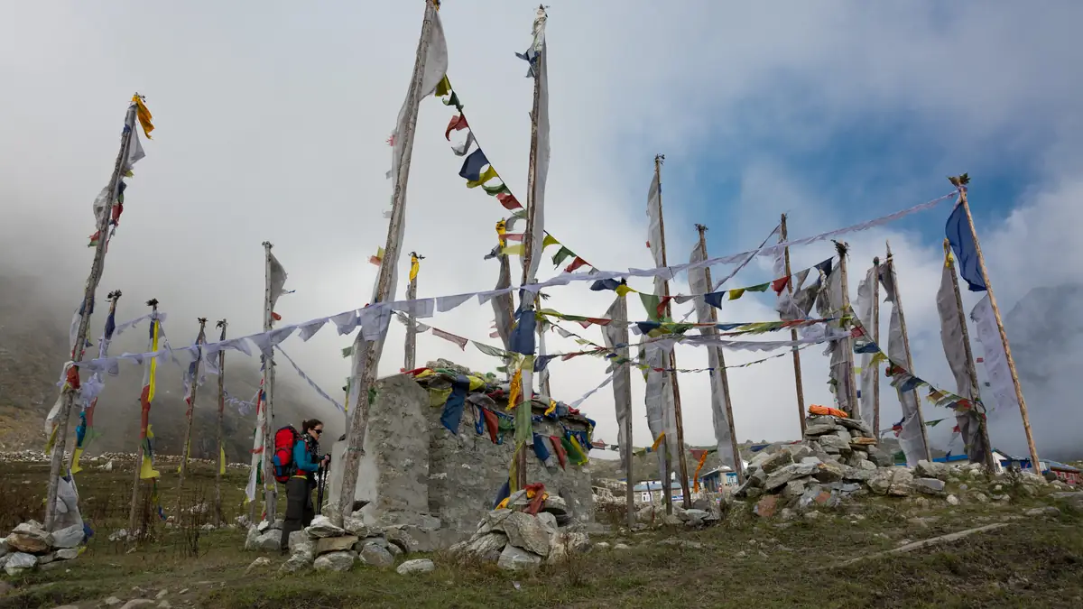
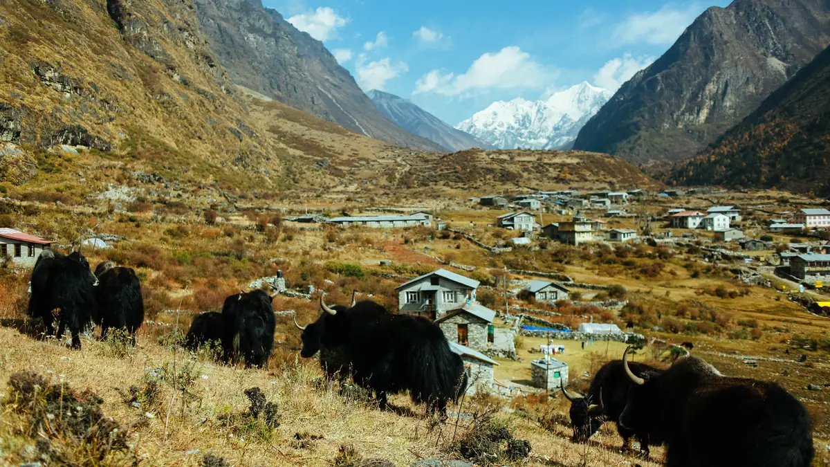
At 11:56 am on 25 April 2015 the magnitude 7.8 earthquake struck Nepal; in the Langtang valley a hanging block of glacier broke off the south face of Lirung, tore snow, ice, rock and earth with it on the way down and within minutes buried almost the whole of Langtang village under millions of tonnes of debris. The blast wave alone flattened the forest on the opposite side of the valley. The official toll is 306 dead: at least 175 of the roughly 370 locals present, 82 Nepalis from other regions – guides, porters, lodge staff – and 49 foreign trekkers; the residents themselves assume more, and many of the dead were never found. The survivors were flown to Kathmandu by helicopter and lived for months in a monastery in the city. A year later they went back and rebuilt the village around a hundred metres above the old site, largely with their own means and donations because state aid came slowly; the first lodges opened in 2016, and today two dozen houses of stone and tin stand there again. By the trail stands a memorial mani wall with the names of the dead, “forever in our hearts” in eleven languages. Anyone walking through the valley today passes the edge of the debris – the operators mention it with varying openness: Accessible Adventure, Namaste Nepal, Wonder Himalaya and Nepalaya name the earthquake in the itinerary, Mount Face and Alpine Luxury the rebuilding as a reason for the trip. The valley has been open again since 2016, the trails have been rebuilt, and the number of trekkers is again above that of before 2015. What remains is the question of safety: the debris mass is stable, the new lodges stand outside the fall zone, and the Lirung glacier is monitored – a residual risk as in any high mountain valley, no reason not to go.
The altitude: up fast, so walk slowly
The Langtang trek is lower than Everest and Annapurna, but faster: from Syabrubesi (1,460 m) to Kyanjin Gompa (3,870 m) is three days and 2,400 m of ascent, with nights at 2,470 and 3,430 m – the rule of thumb of at most 500 m of sleeping altitude gained per day above 3,000 is exceeded twofold on day three. Most people tolerate it; anyone who gets a headache, nausea or sleeplessness at Langtang should not go on to Kyanjin the next day but stay. The summit day is also the acclimatisation day: climb high (4,773 or 4,984 m), sleep low (3,870). Packages without a second night at Kyanjin (Nepal High Trek, Himalayan Recreation, Treklanders, Accessible Adventure) forgo that day – if you book one of them, add a day at Langtang or Kyanjin if your body asks for it. Diamox as prevention is a question for your doctor with three nights above 3,400 m, not a must; Base Camp Adventure, Himalayas On Foot, Unique Path and Trek & Adventure carry an oximeter, Trek & Adventure also oxygen. In an emergency the helicopter is the only fast rescue – hence the insurance to 5,000 m that 47 packages list in their exclusions. And the Khumbu cough is called the Langtang cough here: dry air, cold nights, a scarf over your mouth helps.
Best time: month by month
| Months | Weather in the valley | Road, lodges, summit | Assessment |
|---|
| October | Clear and dry after the monsoon, 15 °C by day in Kyanjin, around zero at night | Road mostly dry, lodges full, Kyanjin booked out early; Tserko Ri free of snow | The best time; Dashain and Tihar bring crowded buses |
| November | Clear, colder, −5 °C at night in Kyanjin; best distant views of the year | Road good, lodges full until mid-month, then emptier | Very good; the second half of the month is quieter |
| December–January | Cold and clear, −10 to −15 at night; snow possible from Langtang up | Some lodges at Kyanjin closed, Tserko Ri often snow-covered, Lauribina La closed | Doable with gear; empty and cheap; Annapurna Foothills recommends it |
| February | Cold, first rhododendrons low down, remnants of snow higher up | Lodges reopen, few guests | Good for those who do not mind the cold |
| March–April | Rhododendrons in bloom up to Ghoda Tabela, mild, cloud in the afternoon | Road good, lodges moderately full, clear views in the morning | Second-best time; haze at low altitude |
| May | Warm, humid low down, thunderstorms in the afternoon, pre-monsoon | Lodges emptier, first landslides on the road | Still possible, views deteriorate |
| June–September | Monsoon: rain almost daily, mist, leeches in the forest up to 3,000 m | Landslides at Ramche and Doman, bus cancellations, bridges damaged; lodges open | Not recommended; Gosaikunda has its pilgrimage festival in August, September improves towards the end |
Assessments from operator texts (Annapurna Foothills, Namaste Nepal, Peregrine) and the valley's position north of the main ridge; not a weather forecast. Temperatures are guide values for Kyanjin Gompa.
What to bring – and what 13 packages lend
A teahouse trek needs no tent and no stove, but a sleeping bag to −10 °C (the blankets at Kyanjin are enough in October, not in December), a down jacket for the evenings, poles for the 2,400 m of descent, sturdy boots, a rain jacket, a headtorch for the summit morning, sunglasses and sunscreen for the altitude, a water bottle with filter or tablets, a small first-aid kit with blister plasters, and in winter spikes for Tserko Ri. Sleeping bag and down jacket are lent by 13 packages: Cordial, Nepal Lion, Outshine, Base Camp Adventure, Ace, Alpine Club, Mountain Tiger (sleeping bag and poles), Himalayas On Foot, Accessible Adventure, Glorious, Himalayan Social Journey, Travel Maker, Mountain Mart, Unique Path, Global Holidays, Incredible Treks – each to be returned. Anyone booking elsewhere rents in Thamel for one to two dollars a day. The bag for the porter should not exceed 10 to 12 kilos (one porter per two guests, 20 to 25 kilos together); the daypack with water, jacket and camera stays with you. Cash in rupees, passport, insurance policy, power bank – electricity costs and fails.
Questions about park and best time
Can I go without a guide?
Officially no longer: since 1 April 2023 the Nepal Tourism Board requires a licensed guide for foreign trekkers in national parks, Langtang is on the route list, and checks are made at the posts at Dhunche and Ghoda Tabela. The fine per the guidelines: NPR 12,000. All packages here include the guide; if you want only him, take Tours and Treks or Cordial from USD 290 for two.
Is the valley safe after the earthquake?
As safe as a high mountain valley can be. The new Langtang stands outside the 2015 fall zone, the trails have been rebuilt, the debris mass is considered stable, and the valley has been fully back in operation since 2016. A residual risk from landslides in the lower valley (near Doman, especially in the monsoon) and from avalanches in winter remains – as everywhere in the Himalaya. The residents want guests; every night in the village is part of the rebuilding.
Which vaccinations and which insurance?
No compulsory vaccinations; the usual ones are recommended (hepatitis A, typhoid, tetanus), rabies for long stays. The insurance must cover trekking to 5,000 m and helicopter rescue – a flight from Kyanjin to Kathmandu costs several thousand dollars, and the operators arrange it only against a guarantee from the insurer. Take the policy number and emergency number printed out.
Is there mobile coverage and Wi-Fi?
A Nepali SIM (Ncell, NTC) works to Syabrubesi and in places to Langtang; at Kyanjin most lodges have Wi-Fi for NPR 300 to 500 a day, often slow. Electricity from micro-hydro and solar, charging NPR 200 to 400 per device. Bold Himalaya recommends buying the SIM at the airport.
Is winter worth it?
For anyone who can stand the cold: from December to February the valley is empty, the views clear, the lodge prices negotiable. −10 to −15 °C at night in Kyanjin, Tserko Ri often snow-covered (spikes), some lodges closed, the Lauribina La shut. Annapurna Foothills recommends it explicitly, Mountain Tiger and Wonder Himalaya offer it. The sleeping bag then really has to reach −10.
Sources and check status
Show 10 sources
- ntb.gov.np/plan-your-trip/before-you-come/park-entry-fees – Nepal Tourism Board: Langtang National Park NPR 3,000 per person per entry (accessed 25 September 2026)
- ntb.gov.np/plan-your-trip/before-you-come/tims-card – Nepal Tourism Board: TIMS NPR 2,000 (SAARC 1,000), rules from 31 March 2023, route list with Langtang (accessed 25 September 2026)
- kathmandupost.com/money/2023/03/31/nepal-tourism-board-has-issued-new- – Kathmandu Post, 31 March 2023: NTB guidelines, 44 routes with guide requirement, NPR 12,000 fine (accessed 25 September 2026)
- kathmandupost.com/money/2023/03/04/no-more-solo-treks-guides-mandatory – Kathmandu Post, 4 March 2023: guide requirement from 1 April 2023, TIMS raised to NPR 2,000 (accessed 25 September 2026)
- www.himalmag.com/politics/nepal-langtang-earthquake-disaster-recovery – Himal Southasian, 25 April 2025: glacier collapse on Lirung, 306 dead (175 locals, 82 Nepalis, 49 foreigners), rebuilding a hundred metres above, slow state aid (accessed 25 September 2026)
- en.wikipedia.org/wiki/Langtang_National_Park – Wikipedia (secondary source): established 1976, 1,710 km², buffer zone 420 km² since 1998, districts, Gosaikunda as a Ramsar site (accessed 25 September 2026)
- epermit.ntnc.org.np/ – NTNC ePermit: children under ten without permit, single entry (for Annapurna; Langtang rule analogous at the DNPWC) (accessed 25 September 2026)
- www.langtangtreks.com/blog/kathmandu-to-syabrubesi-bus-vs-jeep-options – Langtang Treks (operator, secondary source): permit check at the Dhunche army post, Ramche landslide zone (accessed 25 September 2026)
- www.viator.com/tours/Kathmandu/Langtang-Valley-Trek-10-Days/d5109-6721 – Annapurna Foothills: best seasons October to mid-December and March to May, winter recommended (Viator Partner API) (accessed 25 September 2026)
- www.viator.com/tours/Kathmandu/Langtang-Valley-Trek/d5109-65641P11 – Accessible Adventure: 2015 earthquake and rebuilding in the itinerary (Viator Partner API) (accessed 25 September 2026)