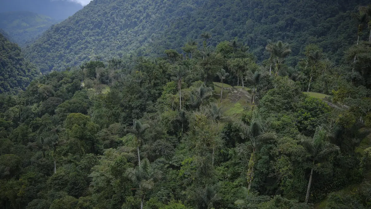
- StartEl Mamey (Machete Pelao) ≈ 150 m, two and a half to three hours by 4×4 from Santa Marta
- Highest pointCiudad Perdida ≈ 1,200 m, one hour and 1,200 steps above the Paraíso Teyuna camp
- NightsCamp 1 (Adán/Alfredo), Camp 3 (Paraíso Teyuna), Camp 2 (Wiwa/Mumake) – with five days, Camp 1 once more
- Distance≈ 46 km there and back; day 1 ≈ 8 km, day 2 ≈ 14 km, day 3 ≈ 12 km, day 4 ≈ 12 km
- Elevation gain≈ 1,100 m up and down again, in waves – no pass, but constant ups and downs
The profile: hot on day one, long on day two, early on day three
The Lost City has no altitude problem, it has a climate problem. Day 1 starts after lunch in El Mamey with the notorious first climb: an hour without shade, at thirty degrees and high humidity, then forest to the camp. Day 2 is the longest hiking day – seven to nine hours depending on the operator – up the Buritaca valley, past the Kogi village of Mutanyi, with a swim in the river, to the top camp Paraíso Teyuna. Day 3 starts before six: river crossing, 1,200 steps, two to three hours in the city, descent to Camp 2. Day 4 is the return via Camp 1 to El Mamey, six to seven hours, mostly downhill and back in the heat.
The five-day version changes only the ending: it sleeps at Camp 1 again on day four and walks the last kilometres to El Mamey on day five. Slow walkers and families gain half a day by the river.
Itineraries of the products
From the Viator product data, shortened. Every operator names the camps differently (Camp 1 / Adán / Alfredo; Camp 2 / Cabaña Wiwa / Mumake; Camp 3 / Paraíso Teyuna / camp of Mamo Romualdo) – they are the same places. Turcol has no usable itinerary in the data (days 2 and 3 identical), Magic Tour only in Spanish.
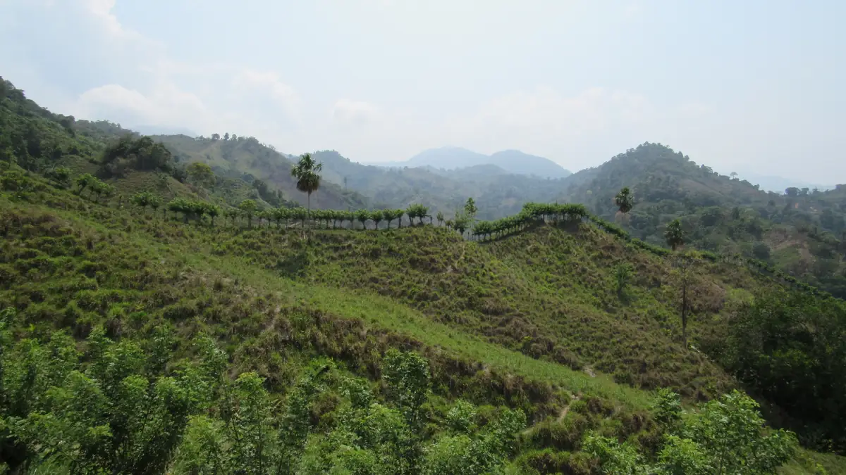
The first hill is the hottest. Everyone says so, everyone underestimates it.
El Mamey is where the road and the power grid end. After lunch the trail climbs at once, in the midday heat and without shade, up to the Mirador de las Tres Cruces. Then the path gets more wooded, and the river waits at the first camp. If you realise here that your pack is too heavy, most operators still let you add a mule.
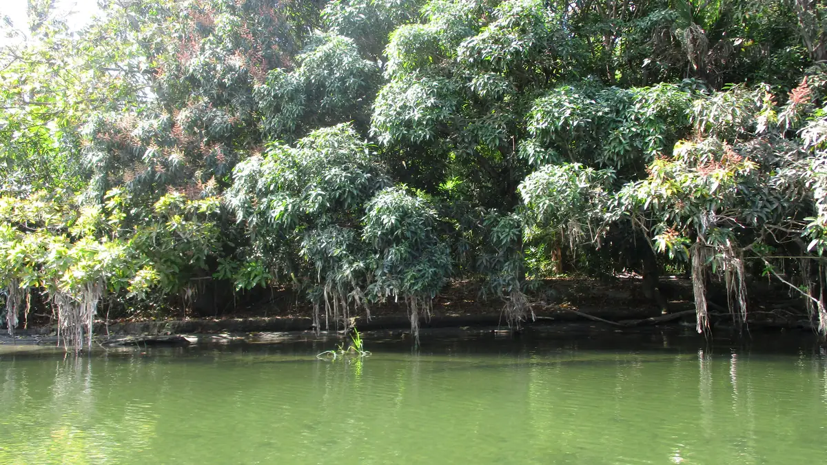
Green water, smooth stones, and everyone jumps in.
The Buritaca accompanies the trek from bottom to top – the Lost City sits on its upper course. At the second camp everyone swims while lunch is cooked. It is the spot where you understand why swimwear and quick-drying clothes matter more than hiking boots.
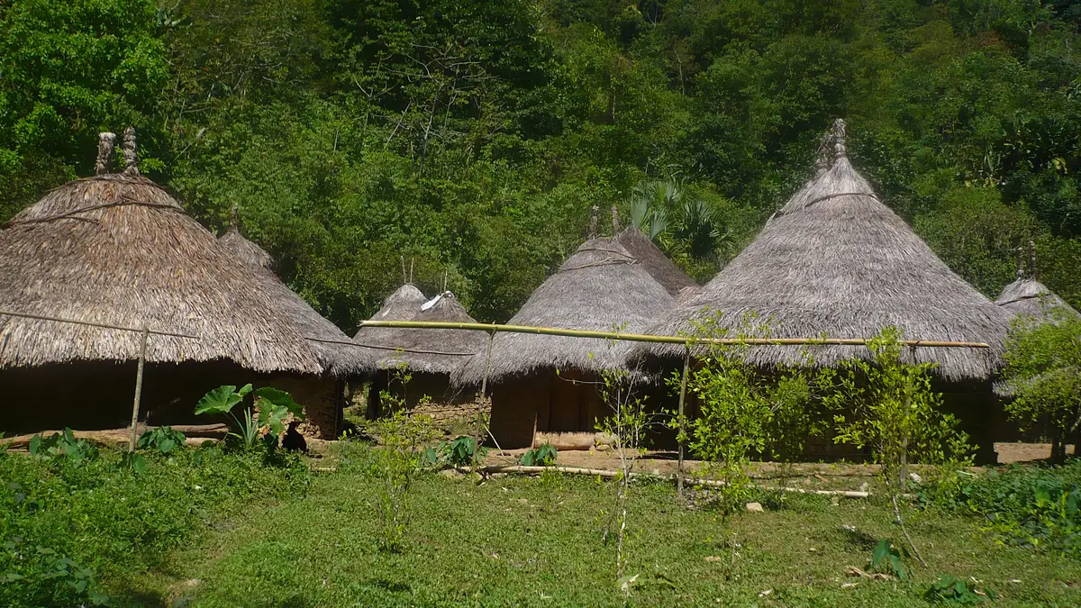
Round huts, white clothing, no photos of people.
Mutanyi is a Kogi village on the trail, not a museum. Groups pass along its edge, the guide explains what he is allowed to explain, and anyone wanting to photograph residents asks – the answer is usually no. With some operators part of the tour price goes to the communities as a contribution; three of the seven products say so explicitly.
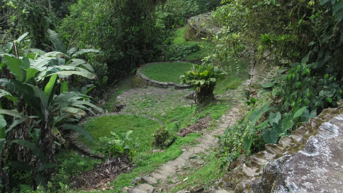
In the river at six, on the stairs at seven, at the top by eight.
The climb starts with a river crossing and ends on 1,200 mossy stone steps built by the Tayrona more than a thousand years ago. They are narrow, wet and steep, but short: one hour. Every operator starts early so groups are at the top before the heat and the fog.
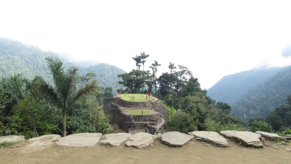
One hundred and seventy terraces. No walls, no roofs, just the rings.
Teyuna was founded around 800, four centuries before Machu Picchu, and rediscovered by looters in 1972. What stands are stone rings, stairs and paths on which the wooden houses stood. The guide leads two to three hours through the terraces; with luck you meet the Mamo, the Kogi spiritual leader who looks after the site.
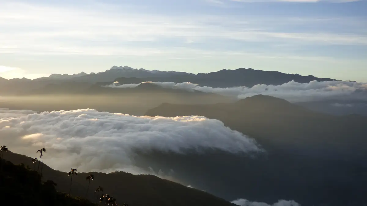
The longest day is the last, and it goes downhill.
Back the same way: Camp 2, Camp 1, the hills before El Mamey. Six to seven hours, mostly downhill, in the same heat as on day one. The five-day version splits the return over two days and sleeps once more by the river. Lunch in El Mamey in the afternoon, then back to Santa Marta – or, with Expotur and Econnection, to Minca, Palomino or the Tayrona park.
The route in stages: altitudes and itineraries from the operator data, photos illustrate the places. The boxes show where the four compared offers differ at the same spot.
Expotur · 4 days 4 days · 3 nights
Start 9:30 am at the Expotur office, two and a half hours by 4×4 to El Mamey, lunch, then the first climb to Camp 1 with river pools and waterfalls nearby.
☾ Camp 1, Bett oder HängematteEarly breakfast, through the Buritaca valley past the Kogi village of Mutanshi, around seven hours through the forest of the Sierra Nevada to Camp 3.
☾ Camp 3, Bett oder HängematteUp the 1,200 Tayrona steps to the Lost City, guided tour of the terraces, time for photos, lunch, then the same way back down to Camp 2.
☾ Camp 2, Bett oder HängematteBack past rivers and waterfalls to cool off as far as El Mamey, lunch, drive to Santa Marta, arriving around 5 pm. Drop-off near Minca, Palomino or the Tayrona park entrances also possible.
Baquianos · 4 days, max. 12 4 days · 3 nights
Meeting point or pickup, about three hours by 4×4 to El Mamey, then roughly six kilometres to the first cabins, with natural pools for a swim on the way.
☾ Bett oder HängematteDeparture 8 am, eight to nine hours to the third camp Paraíso Teyuna, one hour below the Lost City; past the Kogi village of Mutanyi on the way.
☾ Bett oder HängematteOne hour and 1,200 steps up to Teyuna, guided walk through the terraces and rings, possible dip in the “Pozo de la Juventud”, descent to the Mumake cabins.
☾ Bett oder HängematteEarly start, back to El Mamey, home-cooked lunch, 4×4 back to Santa Marta.
Magic Tour · 4 days 4 days · 3 nights
Three hours from your hotel by 4×4 to El Mamey, lunch in the village, four-hour climb to the first camp.
☾ Hängematte oder Bett mit MoskitonetzTwo hours to the Kogi village of Mutanzi, forty minutes to Camp 2 for a hot lunch, four more hours to the camp of Mamo Romualdo (Camp 3).
☾ Hängematte, Bett oder ZeltOne hour up to the Lost City, two-hour tour of the archaeological zone, back to Camp 3 for lunch, four hours to Camp 2.
☾ Hängematte oder BettSeven hours back to El Mamey, lunch, three-hour drive to your hotel.
Econnection · 4 days, most complete list 4 days · 3 nights
Pickup between 7 and 8:30 am, three-hour jeep ride to El Mamey, fruit break at the Mirador de las Tres Cruces, natural pools, night at Camp Adán or Alfredo.
☾ Bett oder Hängematte, MoskitonetzThree hours to Camp 2 “Cabaña Wiwa” with a swim in the Buritaca, twenty minutes to Mutanyi, five hours to Camp 3 with showers, toilets and generator power.
☾ Camp 3, Strom 18–21 UhrTwo kilometres and 1,200 steps up, three-hour guided tour of terraces, paths and ceremonial structures, four-hour descent to Camp 2.
☾ Camp 2Two hours to Camp 1, four hours to El Mamey, lunch, three-hour jeep ride; arrival in Santa Marta between 3 and 5 pm. Start or end in Minca at no extra cost.
To'Buru · 4 days, max. 4 4 days · 3 nights
Start in El Mamey, fruit break at the Mirador de las Tres Cruces, natural pools, night at the first cabins.
☾ Hütte mit Strom, Toilette, DuscheVia Mutanyi and a swim in the Río Buritaca at the second camp to Paraíso Teyuna.
☾ Strom 18–21 Uhr, DuscheTwo kilometres and 1,200 steps to the Lost City, guided visit, lunch at Paraíso Teyuna, descent to Cabaña Wiwa.
☾ Cabaña Wiwa, begrenzte DuschenTwo hours to Camp 1, four hours to El Mamey, lunch; the itinerary says the car returns to Palomino, the pickup note says Santa Marta – clarify before booking.
Impulse Travel · 5 days 5 days · 4 nights
Meet between 8 and 9 am, three hours to El Mamey, lunch at a local restaurant, four hours to the first camp.
☾ Camp, Bett oder HängematteOff at 6 am, two hours to Mutanzi, forty minutes to Camp 2 for lunch, four hours to Camp 3.
☾ CampOff at 6 am, 1,200 steps, at the top around 7 am; two hours in the city, lunch at Camp 3, four hours back to Camp 2.
☾ CampThe day the five-day version gains: only four hours back to the first camp, afternoon by the river, dinner, night.
☾ Camp oder HängematteDescent to El Mamey, lunch at the same restaurant as on day one, back to Santa Marta in the afternoon. (The operator text mentions “2nd camp” and seven hours here – probably carried over from the four-day itinerary.)
Stops and walking times from the operator's Viator product data, edited for length. Maps and figures illustrate the route and are not for navigation.
Camps: how the nights work
The camps are wooden structures with corrugated roofs, open to the forest, run by farming families of the region. There are beds in rows and hammocks, both with mosquito nets, toilets, cold showers and, at the upper camps, generator power from about 6 to 9 pm. Who gets a bed and who a hammock is decided by occupancy in the evening – every operator says “bed or hammock”, none guarantees either. You do not need a sleeping bag, a thin blanket is provided; many bring a silk liner and earplugs. Beer, water and snacks are sold at every camp, in pesos, more expensive the higher you go.
Best season: December to March dry, September closed
The trek runs all year. The driest period is December to March: firm trail, low rivers, clear mornings on the terraces, but the fullest camps. April to June and September to November are rainy seasons with afternoon showers, mud on the trail and river crossings up to the thigh – the forest is at its greenest then, and groups are smaller. July and August sit in between. Regardless of the weather, the park closes for a few weeks every year, usually in September, for the ceremonies of the Kogi, Wiwa, Arhuaco and Kankuamo; the ICANH authority announces the dates together with the communities.
Questions about the route
How hard is the Lost City trek?
Moderate. Altitude plays no role, heat and humidity do. The climbs are short but steep and often shadeless; after rain the clay gets slippery. Regular hikers need no preparation, but should walk slowly and drink a lot – the guides reckon on three to four litres a day.
What are the river crossings like?
On the third morning the Buritaca is crossed before the stairs, usually knee-deep, deeper in the rainy season – then the guides rig a rope. Sandals or water shoes to change into are worthwhile; many cross in their hiking shoes and let them dry during the day.
Is there phone signal or Wi-Fi?
No, not beyond El Mamey. Power for charging is available at the camps for a few hours, often for a small fee. A power bank lasts four days.
What about mosquitoes and vaccinations?
Mosquito nets are on all beds and hammocks; repellent and long clothing in the evening remain necessary. Expotur recommends the yellow fever vaccination as a precaution; it is not required for entry. If in doubt, check with a travel clinic before the trip.
Sources and check status
Show 5 sources
- www.viator.com/tours/Santa-Marta/Lost-City-Trek-Discover-Ciudad-Perdid – Econnection: itinerary with kilometres and hours (Viator Partner API) (accessed 25 September 2026)
- www.viator.com/tours/Santa-Marta/Walk-for-4-days-to-Ciudad-Perdida-San – Expotur: itinerary, camps, end points (Viator Partner API) (accessed 25 September 2026)
- www.viator.com/tours/Santa-Marta/Lost-City-Trek-in-Santa-Marta-Colombi – Baquianos: itinerary with cabin names (Viator Partner API) (accessed 25 September 2026)
- www.viator.com/tours/Santa-Marta/Ciudad-Perdida-4-or-5-Day-Trek-from-S – Impulse Travel: five-day itinerary (Viator Partner API) (accessed 25 September 2026)
- www.icanh.gov.co/ – ICANH: Parque Arqueológico Teyuna – Ciudad Perdida, administration and closures (accessed 25 September 2026)