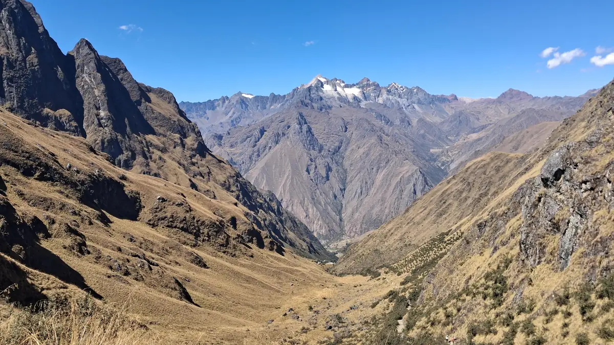
- StartKm 82 checkpoint (Piskacucho) ≈ 2,700 m, ninety minutes' drive from Ollantaytambo
- Highest pointWarmiwañusca, Dead Woman's Pass, 4,215 m on day two; second pass Runkurakay 4,000 m the same afternoon
- CampsAyapata (≈ 3,300 m), Chaquicocha (3,600 m), Wiñay Wayna (≈ 2,650 m) – the same with both operators
- Distance≈ 43 km in four days, the longest day is the second with around 11 km and 7 hours
- FinishInti Punku 2,720 m, then Machu Picchu 2,430 m; bus, train and transfer back to Cusco in the evening
The profile: a gentle day, a hard one, a beautiful one, an early one
Day one is a warm-up: gently rising along the Urubamba, with the view of the Llactapata terraces and lunch at Hatunchaca, then two hours up to Ayapata camp. Day two is why the Inca Trail counts as strenuous: four hours of steps up to Dead Woman's Pass, 600 m down to lunch at Pacaymayo, then up again to Runkurakay Pass and down past Sayacmarca to Chaquicocha. Day three is the one everyone means: cloud forest, Phuyupatamarca, the Intipata terraces, Wiñay Wayna. Day four starts at half past three because the checkpoint opens at half past five and everyone wants to be first at the Sun Gate.
What the profile does not show: the stairs. Long stretches of the Inca Trail are original paving, and the Incas built steps, not switchbacks. Downhill on day three this taxes the knees more than any pass taxes the lungs.
Itineraries of the two products
From the operators' Viator product data, shortened. Apart from the pickup time the itineraries are identical, because path and camps are prescribed.
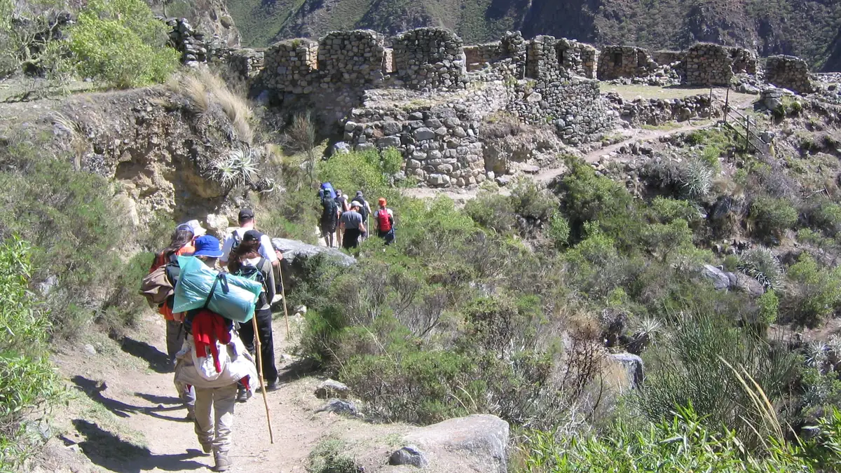
The trail starts at the checkpoint. From here on, your passport counts.
At the Km 82 checkpoint your passport is matched against the permit – the same passport used to book. Then a gentle first day along the Urubamba, with the view of Llactapata as a foretaste.
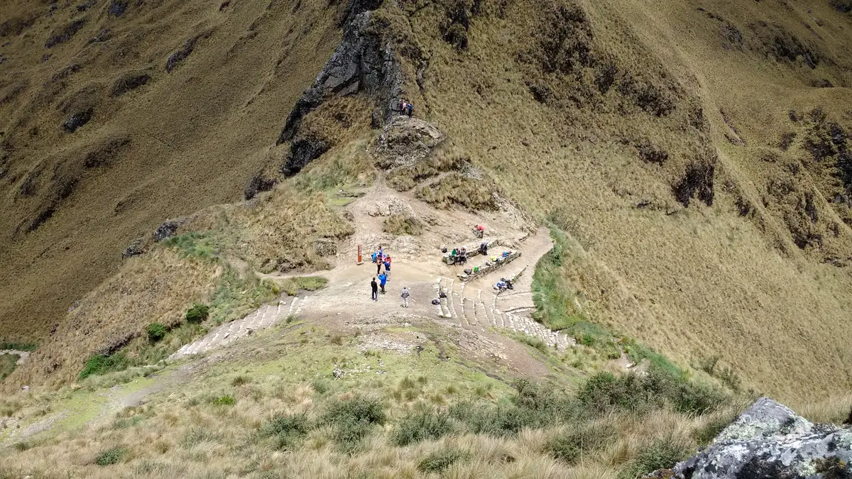
Four hours up. Then you know why it has that name.
The highest point of the route, and the only one where altitude really bites. Then 600 m of steps down to Pacaymayo and a second, shorter pass in the afternoon. Whoever gets through this day well has the trek.
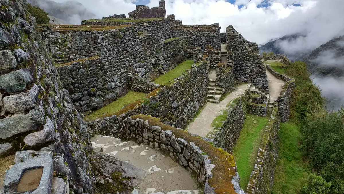
Ruins in the mist, and nobody but your group.
After Runkurakay Pass begins the part that exists only here: Inca sites right on the trail, no bus, no turnstile. Sayacmarca sits on a spur above the valley; Chaquicocha camp is an hour further.
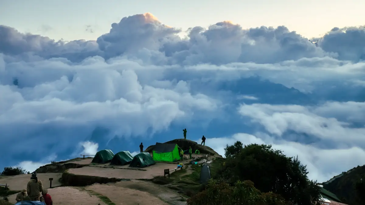
The morning the clouds lie below you.
Day three is the one people mean when they rave about the Inca Trail: cloud forest, orchids, original Inca paving and the view from the “place above the clouds” down to the Urubamba.
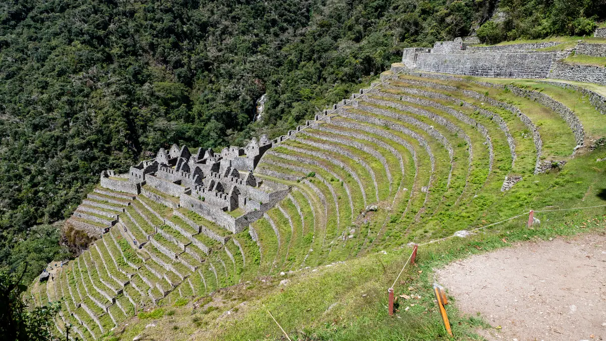
Terraces on the slope, Machu Picchu a day away.
The last night is beside a site that would be world-famous without its neighbour. Evening guided visit of the terraces, then the farewell dinner with porters and cook – this is where tips are given.
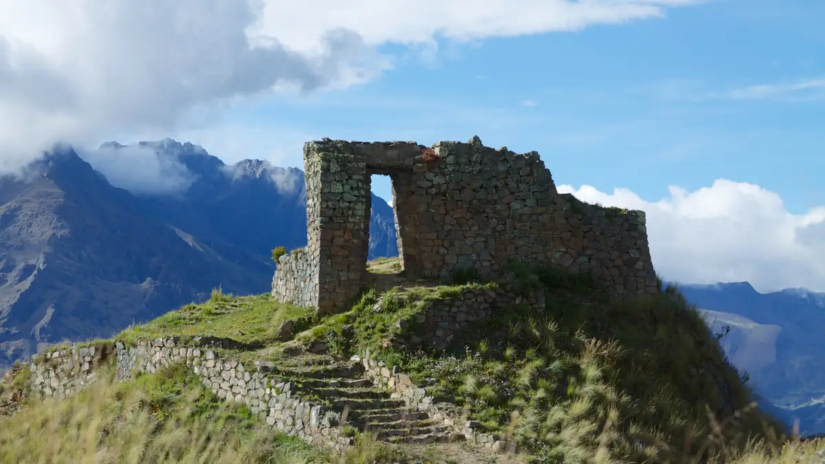
On foot through the Sun Gate. Only this route has it.
The checkpoint opens at 5:30 am, two hours later you stand in the Sun Gate and Machu Picchu lies below you before the first buses arrive. Then circuits 1 and 3, bus down, train to Ollantaytambo.
The route in stages: altitudes and itineraries from the operator data, photos illustrate the places. The boxes show where the four compared offers differ at the same spot.
TreXperience · Inca Trail 4 days 4 days · 3 nights
Pickup 4:30 am, breakfast in Ollantaytambo, checkpoint Km 82 (2,700 m). Villages, view of the Llactapata ruins from the Willkaraqay viewpoint, lunch at Hatunchaca, two more hours uphill to camp.
☾ Camp Ayapata ≈ 3.300 mThe hard day: climb to Dead Woman's Pass (4,215 m), descent to Pacaymayo for lunch, second pass Runkurakay (4,000 m), Runkurakay and Sayacmarca ruins, camp at sunset.
☾ Camp Chaquicocha 3.600 mThe most scenic day: cloud forest, Phuyupatamarca (“city in the clouds”) overlooking the Urubamba, Intipata terraces, afternoon guided visit of Wiñay Wayna, farewell dinner with the crew.
☾ Camp Wiñay Wayna ≈ 2.650 mCheckpoint opens 5:30 am, climb to the Sun Gate Inti Punku, entry via circuit 1 (upper path), then circuit 3 in the main area. Bus to Aguas Calientes, Vistadome train to Ollantaytambo, transfer to Cusco, arrival around 7:30 pm.
Alpaca Expeditions · Inca Trail 4 days 4 days · 3 nights
Pickup 4:20 am, breakfast at the porters' house in Ollantaytambo, one-hour drive to the Km 82 checkpoint (Piskacucho). Via Llactapata to Ayapata.
☾ Camp AyapataFour-hour climb to Dead Woman's Pass (4,215 m), descent to Pacaymayu, second climb and descent to Chaquicocha.
☾ Camp ChaquicochaLast hiking day with views of Salkantay and the Vilcabamba range. Climb to Phuyupatamarca (3,600 m), descent via Intipata to Wiñay Wayna.
☾ Camp Wiñay WaynaEarly breakfast, two hours to the Sun Gate, guided visit of Machu Picchu, return by train (Expedition or Vistadome, see reservation) and transfer to Cusco.
Stops and walking times from the operator's Viator product data, edited for length. Maps and figures illustrate the route and are not for navigation.
The ruins along the way – and why they make the trail
Llactapata from above on day one, Runkurakay as a round watchpost at the pass, Sayacmarca on its spur, Phuyupatamarca with its fountains, the terraces of Intipata and Wiñay Wayna on the third evening: none of these sites can be reached by bus. Whoever sees them walked here – that is the difference no other trek in the region offers. The guide leads you through each site; if you want detail, ask about the water channels that still run at Phuyupatamarca and Wiñay Wayna.
When to go: dry season, rainy season, February
May to September is the dry season with clear days, cold nights (below freezing at Chaquicocha camp at 3,600 m) and the most trekkers; this is when permits go first. October and April are the shoulders with changeable weather and better permit odds. November to March it rains, hardest in January and February; the cloud forest on day three is then green and wet, the steps slippery. In February the classic Inca Trail is closed for maintenance; the short trail from Km 104 stays open.
Questions about the route
How hard is the Inca Trail?
Moderate to demanding. Not because of altitude – 4,215 m is manageable for acclimatised hikers – but because of the stairs and the length of day two. If you have spent two nights in Cusco and hike regularly, you will get through. If you have knee trouble, bring poles with rubber tips; metal tips are banned on the trail.
Where do you sleep?
At state-designated campsites that operators are assigned in advance with the permit. Ayapata, Chaquicocha and Wiñay Wayna are the usual ones; depending on allocation a camp may differ. Toilets are camp facilities; both products compared here also bring a private chemical toilet.
Can I hike the Inca Trail without a guide?
No. The classic Inca Trail is allowed only with a licensed operator and guide; permits are issued to operators only. The Salkantay is the route without this rule.
How much do I carry myself?
Both operators carry 7 kg of personal gear in a duffel, including sleeping bag and mat if rented. Your daypack keeps water, rain jacket, sun protection, snacks and camera – three to five kilos.
Sources and check status
Show 4 sources
- www.viator.com/tours/Cusco/4-Day-Inca-Trail-Trek-to-Machu-Picchu-and-P – TreXperience: itinerary with altitudes (Viator Partner API) (accessed 23 September 2026)
- www.viator.com/tours/Cusco/Classic-4-Day-Inca-Trail-Trek-to-Machu-Picc – Alpaca Expeditions: itinerary with altitudes (Viator Partner API) (accessed 23 September 2026)
- www.gob.pe/sernanp – SERNANP: access rules and February closure of the Inca Trail (accessed 23 September 2026)
- www.senamhi.gob.pe/ – SENAMHI, Peruvian weather service: dry and rainy season, Cusco region (accessed 23 September 2026)