- StartKiswarani in the Lares valley, after market, hot springs and lunch; early-morning pickup in Cusco
- Highest pointCondor Pass 4,750 m on day two
- CampsBlue Lagoon 3,900 m (lake), Canchacancha 3,750 m (village), then hotel in Aguas Calientes 2,040 m
- Distance≈ 33 km over two hiking days plus four hours of descent on the third
- FinishMachu Picchu 2,430 m on the fourth morning, by bus from Aguas Calientes
The profile: start high, stay high, descend late
Unlike Salkantay and Inca Trail, the Lares does not begin with a warm-up day. The first camp already sits at 3,900 m, higher than Cusco; the first afternoon climbs there from lunch at Kiswarani. Day two is the trek: steadily up past the lakes to Condor Pass, then a thousand metres down into the village. Day three is a gentle descent to Huaran in the Sacred Valley – four hours, with vehicle and train waiting at the end. There is no hiking day four; day four is Machu Picchu.
That makes the profile the least favourable of the three Machu Picchu treks for anyone sensitive to altitude: no descent in between, two nights above 3,700 m. Two nights of acclimatisation in Cusco are a prerequisite, three are better – or the nights before in the Sacred Valley at 2,800 m, which the operator expressly offers with pickup near Pisac.
The product's itinerary
From TreXperience's Viator product data, shortened. Altitudes are the operator's.
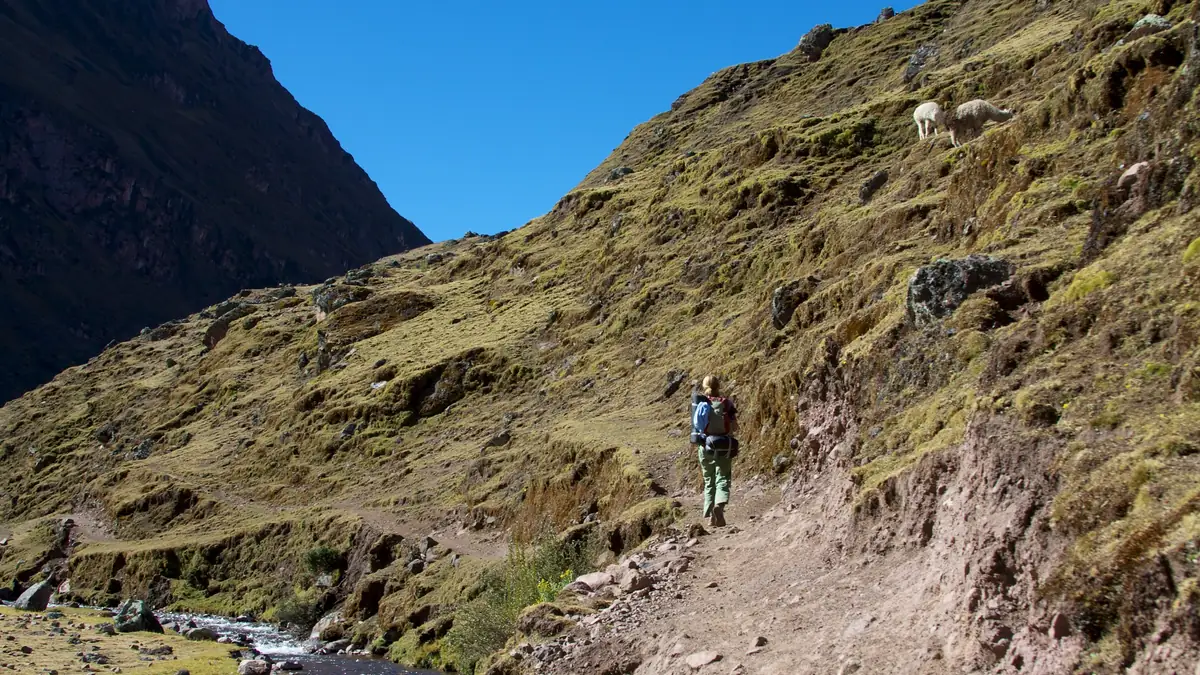
Hot springs first, then the climb.
Day one is half excursion, half trek: Calca market, the giant Puya raimondii plants on the plateau, a soak in the Lares hot springs. Only after lunch at Kiswarani does the walking start – past llamas and alpacas up to the lakeside camp.
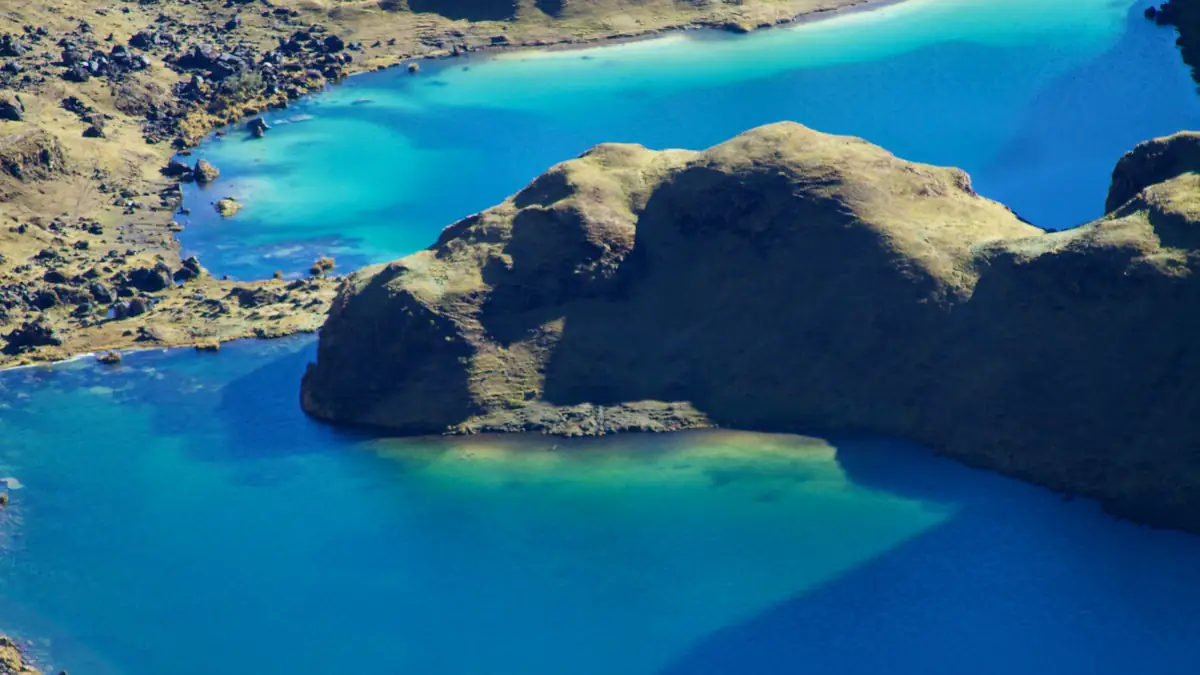
Turquoise, silent, and no other trekker in sight.
Lares is the least trafficked route around Cusco. On the second morning the lakes climb the slope one after another, alpaca herds step aside, Andean geese take off. The pass is not yet in sight.
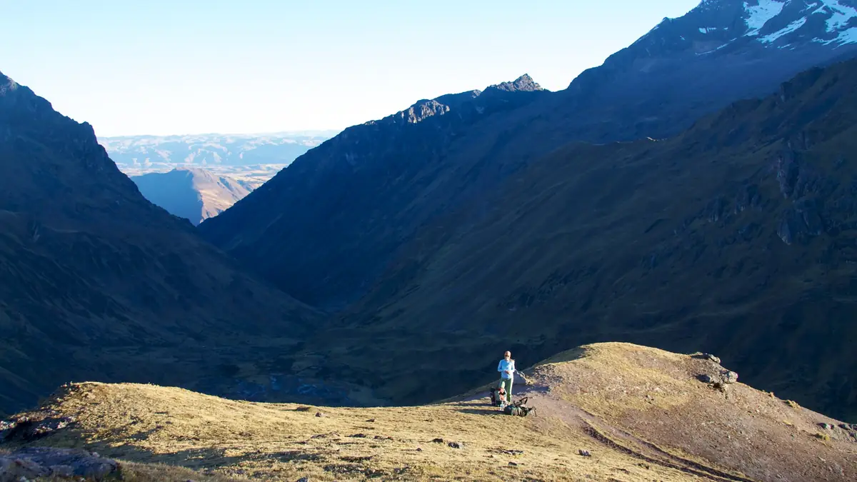
Higher than the Salkantay Pass. Many overlook that.
4,750 m, the highest point of all the Machu Picchu treks we compare. Altitude is the Lares' demand, not distance. Two nights in Cusco beforehand are a must, not a recommendation.
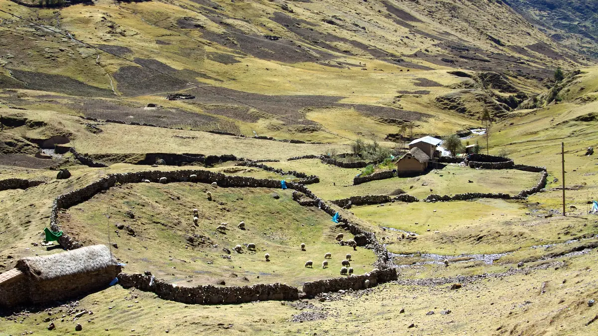
Camp is pitched between the houses.
The second night is why people choose the Lares: the tent stands in the village, children come to play football, the guide translates from Quechua. In the morning a visit to the school – notebooks and pens are welcome, sweets are not.
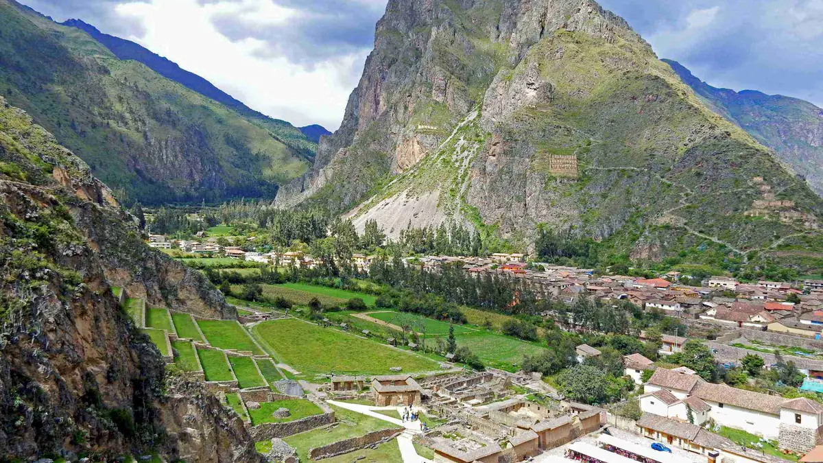
From potato fields to maize, then onto the train.
Four hours downhill, and the landscape changes by the hour: potatoes and beans up high, maize and avocado down in the Sacred Valley. Then car, Maras salt pans, Ollantaytambo, evening train to Aguas Calientes. Last night in a hotel bed.
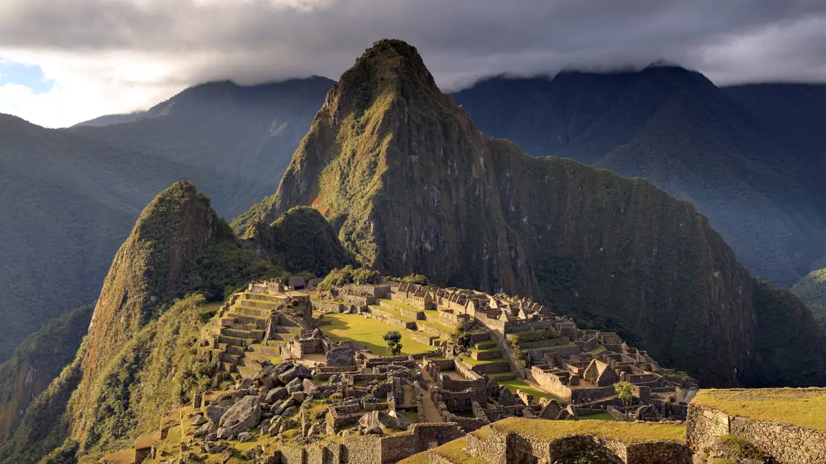
By bus, not through the Sun Gate. But well rested.
The Lares ends like the Salkantay: bus up, guided visit, bus down, Vistadome back. The Sun Gate stays reserved for the Inca Trail – but you had two days of mountains almost to yourself.
The route in stages: altitudes and itineraries from the operator data, photos illustrate the places. The boxes show where the four compared offers differ at the same spot.
TreXperience · Lares Trek 4 days 4 days · 3 nights
Early pickup in Cusco or the Sacred Valley, Calca market, Ancashmarca Inca site, Puya raimondii plateau, Lares hot springs with breakfast, weaving cooperative. Lunch at Kiswarani, climb through llama and alpaca pastures to the lakeside camp.
☾ Camp 3.900 mThe long day: steady climb past turquoise lakes to Condor Pass (4,750 m), descent to the village of Canchacancha, camp beside the houses, evening with the community.
☾ Camp im Dorf 3.750 mVisit to homes and the school, four hours gently downhill to Huaran (2,700 m) for a picnic, transport to the Maras salt pans and Ollantaytambo, dinner, train to Aguas Calientes.
☾ Hotel 3 SterneBus up for sunrise, two- to three-hour guided visit, back to Aguas Calientes, free lunch, Vistadome to Ollantaytambo, private transfer to Cusco.
Stops and walking times from the operator's Viator product data, edited for length. Maps and figures illustrate the route and are not for navigation.
The villages: what sets the Lares apart from the other routes
The Lares valley is inhabited. The communities live from potatoes, alpacas and weaving; trekking groups are guests, not customers. The night in Canchacancha is not a staged encounter but a camp beside houses, with children who want to play football and a guide who translates from Quechua. In the morning a visit to the school. If you like that, you get it only here; if it makes you uncomfortable, choose another route.
When to go: dry season with frost, rainy season with cloud
May to September: clear days, nights at the lake camp well below freezing – a good sleeping bag matters more than on the Salkantay. October to April: rain, mist on the pass, but green pastures and empty camps. The Lares has no closure; the Machu Picchu ticket is available year-round but goes early in high season.
Questions about the route
How hard is the Lares Trek?
Moderate in distance, demanding in altitude. The pass day has around 850 m of ascent and 1,000 of descent over 15 km; the altitude of 4,750 m turns that into six to seven hours. Horses carry the gear; a riding horse for emergencies is available with most operators for a fee on site.
Are there variants of the route?
Yes, several. The Lares region has different valleys and passes; “Lares Trek” is a collective name. The product checked here goes via Kiswarani, Condor Pass and Canchacancha to Huaran. Other operators start in Lares itself or finish in Ollantaytambo. When comparing, what counts is: which pass, which camps, how many hiking days.
Can I do the Lares without a guide?
Legally yes, there is no permit. Practically difficult: no waymarking, no lodging, communication in Quechua. This page compares guided tours.
Sources and check status
Show 3 sources
- www.viator.com/tours/Cusco/Lares-Trek-to-Machu-Picchu-4-days-with-Pano – TreXperience: itinerary with altitudes (Viator Partner API) (accessed 23 September 2026)
- www.senamhi.gob.pe/ – SENAMHI: climate Cusco region, dry and rainy season (accessed 23 September 2026)
- www.gov.uk/foreign-travel-advice/peru/safety-and-security – UK Foreign Office: altitude sickness and trekking in Peru (accessed 23 September 2026)